
Maps can help us get from one place to another. They can also take us back in time as these maps do. These maps show us where significant events happened, where frontiersmen settled and converted Indian trails to roads. The Battle of Mill Springs map shows gives a glimpse into military strategies employed during the Civil War as well as the sophistication and precision necessary in military cartography. And an 1841 trip down the Ohio and Mississippi rivers on foot or steamboat comes to life with the Traveler's Guide.
Conclin, George. Traveler's Guide: A Map of the Ohio and Mississippi Rivers. Extending from Pittsburgh to the Gulf of Mexico, 1841, S18957
Gardiner, Florence. Early Trails Through Barren, Metcalfe and Hart Counties, Kentucky, 1941, SB2-18923
Julius Bien & Company, Sketch of the Enemy's Fortified Position at and opposite Mill Springs, Kentucky, to which he retreated after his defeat at Logan's Cross-Roads; Sketch of the Battle-Field of Logan's Cross-Roads, Kentucky, 1862, S18980
Kentucky Historical Society. The Great Settlement Area 1750-1800, 1975, S27446
Oakes, John Warren. A Map of the Settlement Bowling Green, Kentucky 1860, nd, S19200
Smith, Karl. An Historical and Geographical Map of the State of Kentucky, the Dark and Bloody Ground, 1933, S8072
Washington, Kentucky, nd, SB2-19751
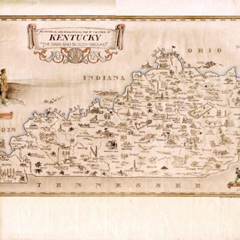
An Historical and Geographical Map of the State of Kentucky, the Dark and Bloody Ground
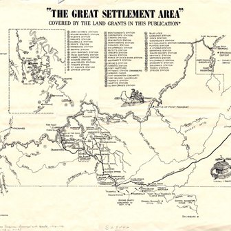
The Great Settlement Area 1750-1800
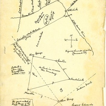
Early Trails Through Barren, Metcalfe and Hart Counties, Kentucky
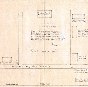
Washington, Kentucky
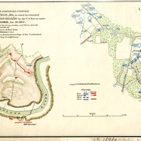
Battle of Mill Springs, Kentucky
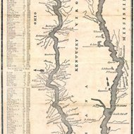
Traveler's Guide
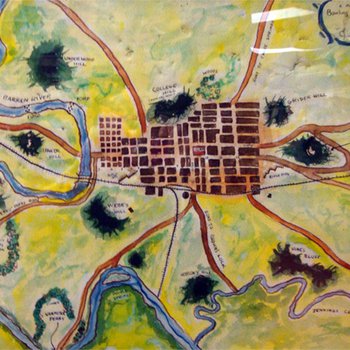
A Map of Settlement of Bowling Green, Kentucky, 1860