

Preview
Creation Date
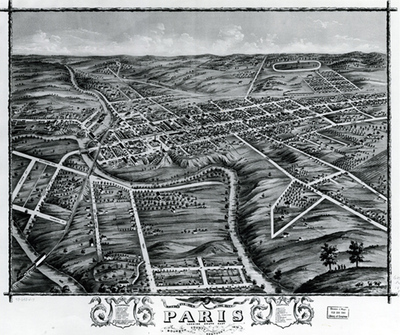
1870
Description
Bird's eye views were very popular in the 19th century, just as aerial and satellite photography is now. These maps allowed a cartographer to use his skill and imagination to lay out a city on a topographical map. This particular map shows Paris, Kentucky and a section of Bourbon county. There are farms, railroads, churches and race tracks; rivers, hills and bluffs all under a blue sky.
Copyright open, copies of this map may be obtained for fee of $10.00. Contact spcol@wku.edu for more information.
Keywords
Maps, Mapmaking, Cartography, Kentucky, Paris