
Allen County History and Bibliography
Abstract
(1st paragraph of overview)
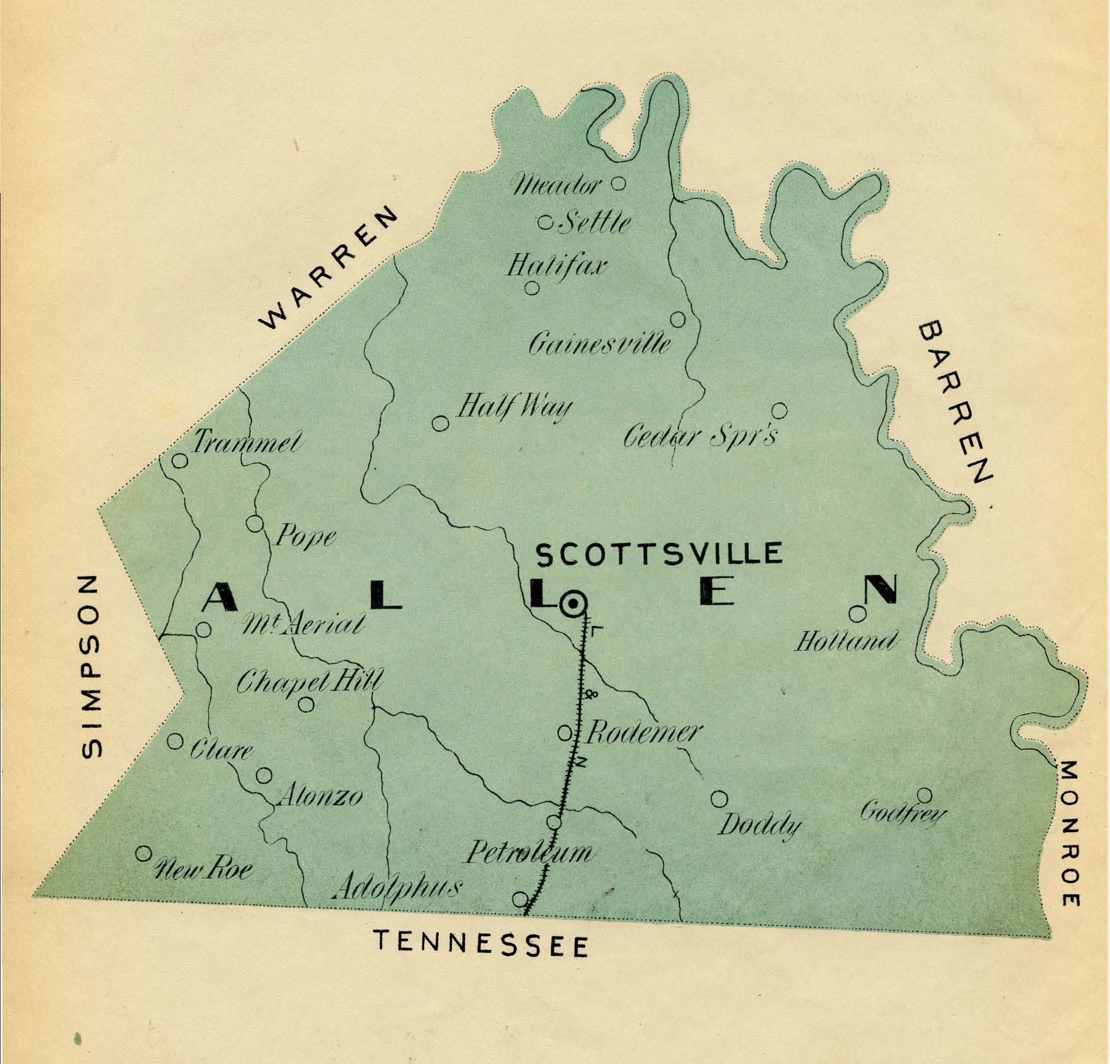
Allen County, Kentucky, is located in the south central portion of the state along the Kentucky-Tennessee border. On that border, Allen County meets the Tennessee counties of Sumner and Macon. Within the Commonwealth, it is bounded by to the northwest and northeast by Warren and Barren counties (respectively), Monroe County to the east, and Simpson County to the west. The county’s northern/eastern boundary is drawn by the Barren River and Barren River Lake. It is located in the Pennyroyal region of Kentucky, between the Central Lowlands and the Appalachian Plateau. Its area is equal to about 344 square miles, according to the 2010 U.S. Census.[i] The topography of this land area is comprised of limestone deposits, springs, and sinkholes, with soil that maintains a texture like clay. Overall, the county remains a relatively rural area, historically harboring agriculture, though some industry does exist. In 2010, the population was estimated around 20,600 people.[ii] The centrally located city of Scottsville serves as the county seat. Some communities/towns within the county include Adolphus, Allen Springs, Halfway, Holland, Petroleum, Pope, Trammel, Meador, and others.
Disciplines
Historic Preservation and Conservation | United States History
Recommended Citation
Department of Library Special Collections and Smith, Brookelyn, "Historical Overview of Allen County, Kentucky" (2017). Allen County History and Bibliography. Paper 2.
https://digitalcommons.wku.edu/hb_ac/2