
Monroe County History and Bibliography
Abstract
(1st paragraph of overview)
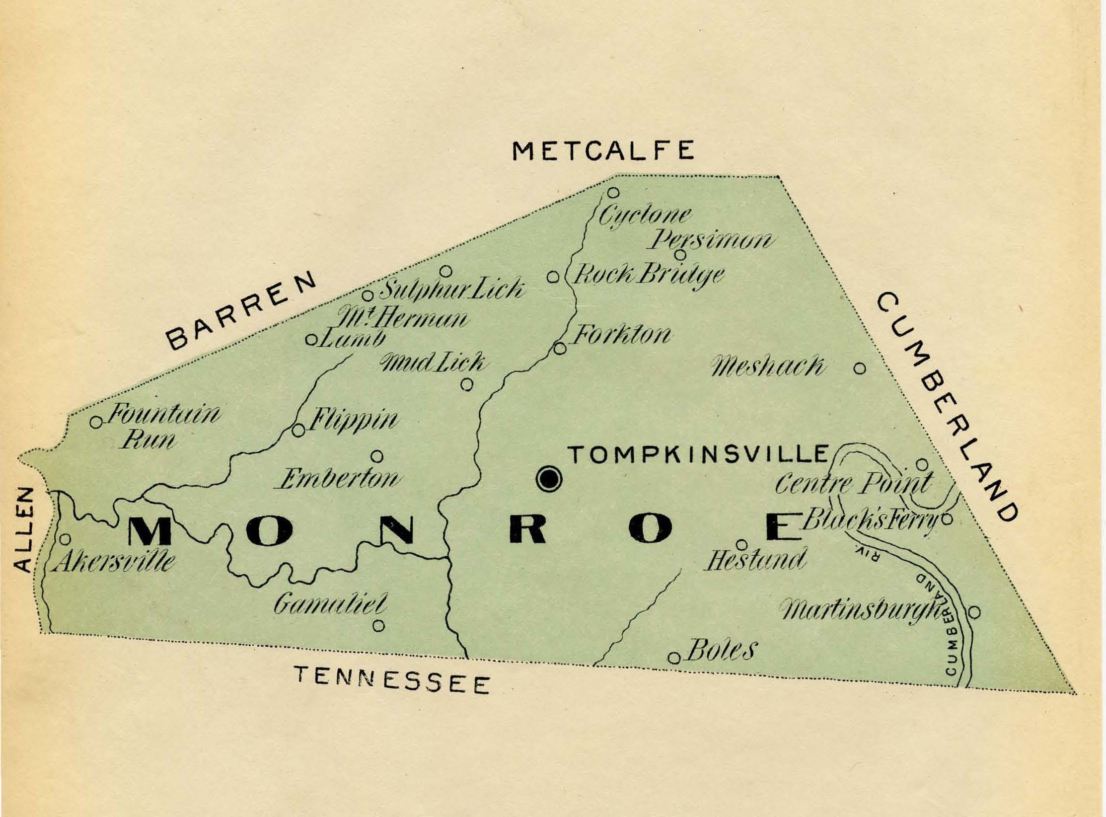
Monroe County, Kentucky (1997 estimated population, 11, 223) is located in the south central portion of the state alongside the Kentucky-Tennessee border. It is part of what is known as the Pennyrile (Pennyroyal) region, an area named for the native medicinal plant, and situated between the Central Lowlands of the Midwest and Appalachian Plateau. Monroe County’s hilly topography is heavy with limestone and shale deposits, and the soil ranges from medium to low in fertility. The Cumberland River is the county’s major waterway and winds through the eastern portion of the county, while the Barren River lies in its southwestern section. Monroe County is largely rural in name with agriculture as the historically dominant economic base. Manufacturing concerns are limited and currently employ approximately 2,000 people. Wholesale and retail trades hire around 700 workers. Tompkinsville, which is centrally located in the county, serves as the county seat and is the county’s largest town with a 1996 population of approximately 2,827 residents.i A number of small communities dot the rural landscape of Monroe County and include Gamaliel, Fountain Run, Mud Lick, Sulphur Lick, Persimmon, Meshack, Flippin, and Hestand.
Disciplines
Historic Preservation and Conservation | United States History
Recommended Citation
Thomason, Philip and Department of Library Special Collections, "Historical Overview of Monroe County, Kentucky" (2017). Monroe County History and Bibliography. Paper 1.
https://digitalcommons.wku.edu/hb_mc/1
Comments
Written by Philip Thomason.
Estimated date 2001