

Preview
Creation Date
1918
Description
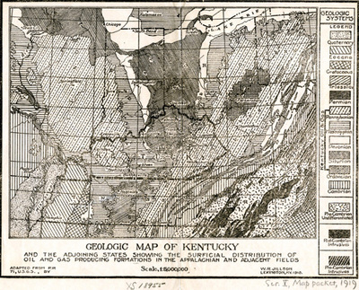
Geologic map of Kentucky showing the distribution of oil and gas producing formations in the Appalachian and adjacent fields. The map includes Illinois, Indiana, Ohio, West Virginia, Tennessee and parts of Missouri, Arkansas and Virginia. This map was created under the direction of W.R. Jillson, State Geologist of Kentucky.
Copyright open, copies of this map may be obtained for fee of $10.00. Contact spcol@wku.edu for more information.
Keywords
Maps, Mapmaking, Cartography, Kentucky, Oil, Gas