

Preview
Creation Date
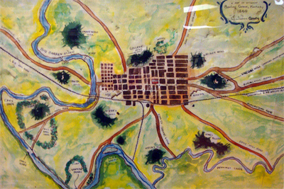
1860
Description
A painting as a map, a map as a work of art, here are both in one. John Warren Oakes has used water colors to represent Bowling Green as it was in 1860. The scale is approximate, but in the use of river bends, roads and railroads one can locate long gone features on a modern map.
Copyright held by John Warren Oakes, map may not be reproduced.
Keywords
Maps, Mapmaking, Cartography, Bowling Green, Kentucky