
Maps and Plates from 1902 Encyclopedia
The maps and plates in this series were rescued from: “Universal Cyclopedia and Atlas a new edition under direction of Charles Kendall Adams, LL.D., president of the University of Wisconsin, editor-in-chief assisted by a corps of associate editors composed of the ablest and most distinguished scholars in the United States and Canada, and of Eminent specialists in both Europe and America; a newly revised and enlarged edition, Rossiter Johnson, Ph.D., LL.D., editor of revision; illustrated with colored plans, plates and engravings; complete in twelve royal octavo volumes; New York: D. Appleton and Company Publishers, 1902.” The order chosen for each section was imposed; originally the maps and plates fell alphabetically within the twelve volumes. The illustration/map index for each volume can be found as the initial pages of the section marked “Illustrative Plates from a 1902 Encyclopedia.”
Submissions from 1902
Illustrative plates from a 1902 Encyclopedia, Kentucky Library Research Collection
Maps of Cities Worldwide, Kentucky Library Research Collection
Maps of Countries Other Than the United States and Canada, Kentucky Library Research Collection
Maps of U.S. States and Canadian Provinces, 1902, Kentucky Library Research Collection
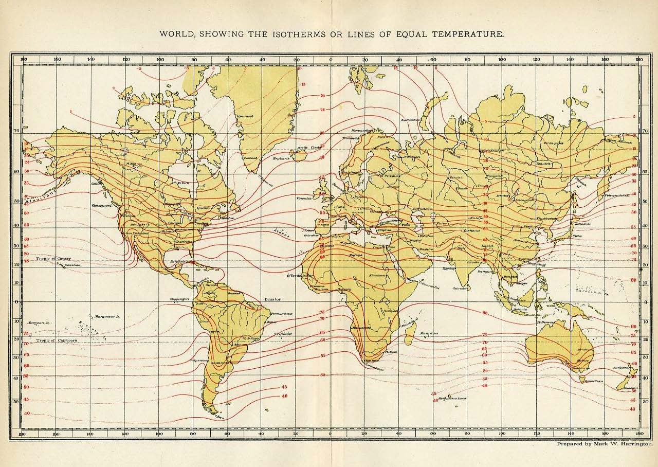
Special Purpose Maps from 1902, Kentucky Library Research Collection