

Preview
Creation Date
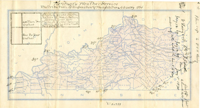
1-1894
Description
Map depicting the distribution of temperature and precipitation for the month of January 1894. Bands have been drawn across a Kentucky county base map indicating the levels of temperature and precipitation.
Copyright open, copies of this map may be obtained for fee of $10.00. Contact spcol@wku.edu for more information.
Keywords
Maps, Mapmaking, Cartography, Kentucky, Weather