

Preview
Creation Date
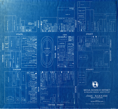
1937
Description
Blueprint map of the Bowling Green retail business district bounded by Chestnut, Eleventh, Center and Eighth Streets created by Jack Barnard in 1937. The map includes Fountain Square Park, includes restaurants, department stores, grocery stores, hotels, churches, theaters and municipal buildings.
Keywords
Maps, Bowling Green, Kentucky, Parks