

Preview
Creation Date
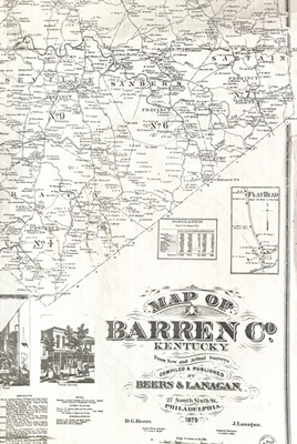
1879
Description
Land ownership map of Barren County, Kentucky. Includes inset maps of Glasgow, Cave City, Glasgow Junction, Hiseville, Flat Head and Rocky Hill, Kentucky. There are business directories for the individual towns, township boundaries and images of selected buildings.
Copyright open, copies of this map may be obtained for fee of $10.00. Contact spcol@wku.edu for more information.
Keywords
Maps, Mapmaking, Cartography, Kentucky, Land Ownership